The Watershed, at Print Size
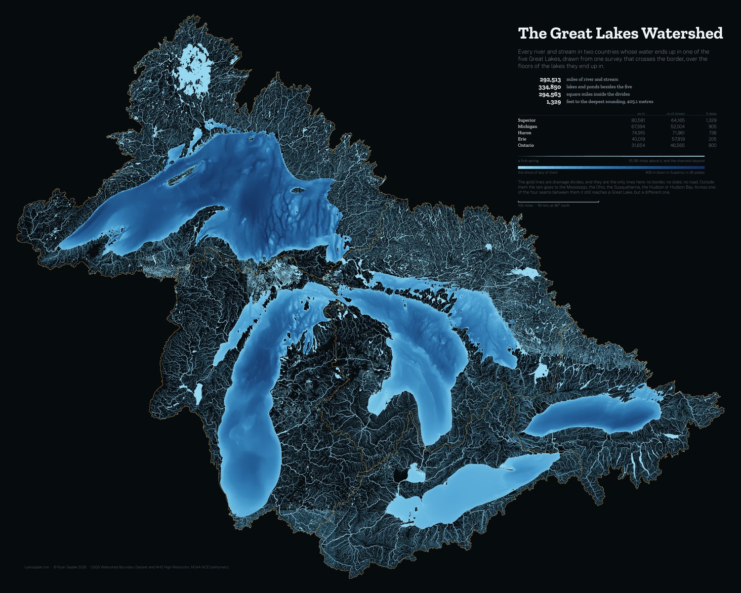
Every river and stream in two countries that ends in one of the five Great Lakes, drawn large enough to hang. Free, at full resolution.

9,000 × 7,200 pixels at 300 DPI, which is 30 × 24 inches on paper. Print smaller and it only gets sharper.
| Basin | Square miles | Miles of stream | Lakes & ponds | Feet deep |
|---|---|---|---|---|
| Superior | 80,581 | 64,165 | 64,912 | 1,329 |
| Michigan | 67,394 | 52,004 | 52,905 | 905 |
| Huron | 74,915 | 71,961 | 109,782 | 736 |
| Erie | 40,019 | 57,819 | 49,968 | 205 |
| Ontario | 31,654 | 46,565 | 57,283 | 800 |
What it is drawn from
The divides are the USGS Watershed Boundary Dataset at HUC4. Region 04 holds thirty-two subregions and twenty-seven of them drain to a lake; grouped into five and measured in an equal-area projection, each basin lands within about a percent of the area its own authority publishes, and the five together come to 762,914 square kilometres against a published 766,000. Many of those subregions are mostly or entirely Canadian and the dataset draws them anyway, which is why the lines do not stop at the border.
The water is the USGS National Hydrography Dataset at high resolution, taken one watershed at a time rather than one state at a time. That is the whole trick: the state files stop at the international border and the watershed files do not, so the Sturgeon, the Wanapitei, the Temagami, the French and the Trent come out of the same survey as the Maumee and the Genesee. NHD ships no usable stream order across most of this basin, so all 1,224,873 reaches were snapped end to end into one network and the miles above each accumulated downhill; that number is what sets how wide it is drawn.
The lake floors are NOAA NCEI's 3 arc-second grids, one per lake, the finest that cover them whole. All five are shaded on one scale, bent towards the shallow end so that Erie's 64 metres and Superior's 406 can be read off the same bar. Every grid's deepest cell lands within six metres of the depth its lake is published at.
Four of the five biggest rivers are lakes
Because the five basins were accumulated as one network and not as five, the water really does add up along the chain. The St. Lawrence leaves Lake Ontario with 77,629 miles of stream behind it, the Niagara leaves Erie with 76,962, the Detroit carries 76,696 and the St. Marys 57,031. The largest thing on the sheet that is only a river is the Maumee, at 15,190, which drains what used to be the Black Swamp and is now the graph-paper grid of ditches you can see northwest of Toledo.
Printing it
It is a lot of dark ink. A matte or lustre paper holds the fine streams better than glossy, and any print shop that takes a 300 DPI JPEG can run it at 30 by 24. Smaller is fine too: at 15 by 12 it is 600 DPI and the headwaters are still there.
Free to print and hang, yours or a gift. If you sell it, that is not free. ☕ Coffee if it ends up on your wall.
There is a sheet of the Lake Ontario basin alone too, drawn at two and a half times this one's resolution.